
Albany Neck and Bulb Bird Survey Protocol
This survey included specific trails where area searches and point counts were conducted.
A point count is a method of counting birds during which a trained observer records all the birds seen and heard from a point count station for a set period of time. In this survey, team members counted birds around a 360º point at a distance of 50 meters during a time period of 2 minutes. Approximately 30 seconds was spent counting birds in each quarter (90 degrees) of the 360º circle. A series of point counts completed over a fixed route can then be compared to the results of the same point counts in other seasons or years.
An area search involves searching throughout a fixed area for a set amount of time and recording the number of birds seen and heard. Here, the fixed search areas were preselected trails, e.g. Shoreline Trail, Top of Bulb, North Side of Bulb, and Neck.
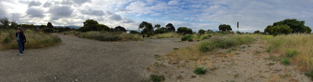
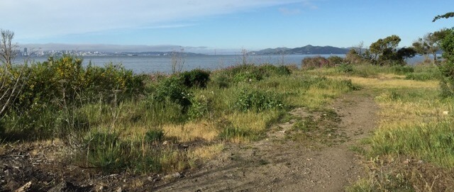
Panoramic view of the top of the Bulb. Photo by Pam Young.
The map of the survey area is on the right. The four survey areas were walked in the following order:
-
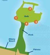
Survey area map. Drawing by Conifer Creative.
(1) SFS — the south-facing slope of the Neck and Bulb, surveyed from the shoreline trail (this area was surveyed first because it heats up earlier in the morning, stimulating early bird activity). This trail was not accessible from June 2015 to November 2015, due to construction activity along the adjacent shoreline. Until the trail opened to the public, the birding teams surveyed the SFS area by looking south (down) from the top of the Neck (and listening for bird calls).
- (2) TOB — the top of the Bulb, was surveyed from the roughly circular trail on top of the Bulb, plus several side trails that lead to viewpoints (V) of adjacent portions of the Bulb.
- (3) NSOB — the north side of the Bulb (not including the top of the Bulb), was surveyed from a trail that heads north from the fairly flat area on top of the Bulb, down to the shoreline; then east along the north shoreline of the Bulb (go as far east as is safely feasible, and then backtrack to the top of the Bulb).
- (4) TON – the top of the Neck, was surveyed by walking east from the east edge of the Bulb to the east end of the Neck. There is no “official” boundary between the east end of the Neck and the west end of the Albany Plateau, but for the purposes of this survey, team members assumed that the east survey boundary is a lone eucalyptus tree on the neck.
Bird Data to be Recorded. During each survey, while following the routes noted above, each birding team noted (separately for each survey area) the number of birds of each species observed. They did not note the specific location of each individual bird.